Online maps created by our users
- Address geocoding from CSV file
- Map of USA states
- Visualize business sales data
- Data mining or marker clustering map
- Filter map markers by category
- Map with routes and multiple layers
- Store locator in France
- Generate maps from spreadsheet data
- ZIP code search on congressional map
- Present multiple database stats
- Density choropleth map
- Census data and demographics map
- Make an online interactive image map
- Route map of rally across provinces
- Crowd sourcing map
- Geographic regions on Google Maps
- Driving routes between locations
- Annotated Interactive Metro Map
Interactive map solution
HTML5 map solution
Showcase
HTML5 Maps With Cross Device Capability
Geocoding address data from CSV file
Map Features:
- Geocoding support - adding locations by using addresses.
- Select category to filter the types of icon to display.
- Markers and tooltip information import from CSV file.
- Insert photo besides the description in infobox.
Possible Extensions:
- Additional filtering of places by other fields.
- Load custom map icons.
- Display markers which are nearest to the searched address.
- Contextual search of textbox information per location.
![]()
![]()
Video Tutorials for Creating Maps Online
 Creates interactive map and custom image map online without programming. Watch our video tutorials below:
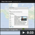
How to create an interactive map by using GMap Editor
How to add markers in the Google Map Editor
Try it free to create maps online.
HTML5 Maps With Cross Device Capability
 iMapBuilder HTML5 mapping software creates interactive map that supports desktops, tablets and mobile (e.g. iPhone and Android devices). Various overlays can be added into the map without coding knowledge.
Download the trial to create your own map.